




Xiongjiawan Coal Mine Geological Disaster Monitoring
更新时间: 2026年5月28日 点击次数:16740
Xiongjiawan Coal Mine Geological Disaster Monitoring
1. Project Overview
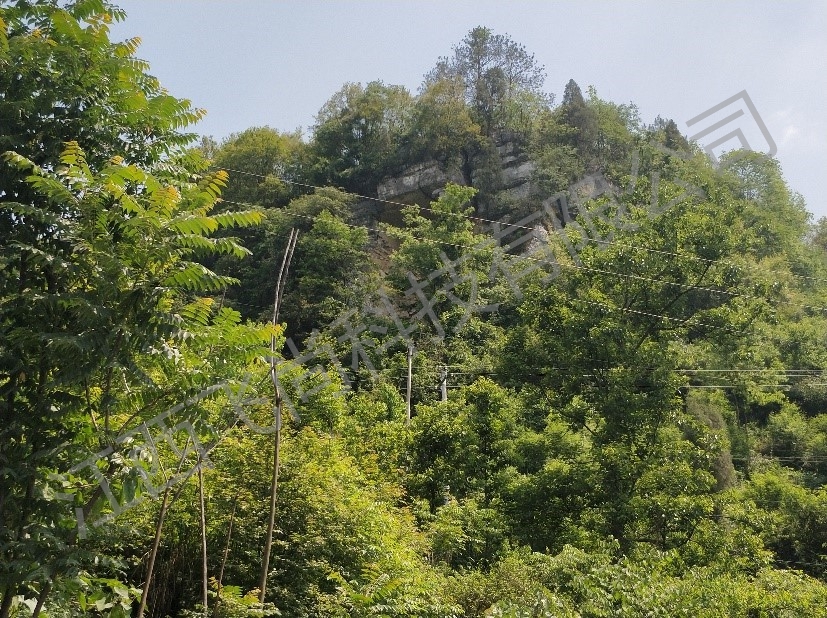
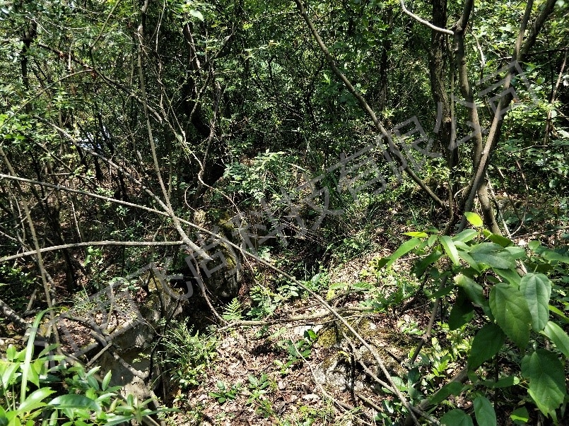
The collapse of Mazonggang in Xiongjiawan Coal Mine is located in Mazonggang Formation, Sanhe Village, Shatu Town, Jinsha County. The collapse occurred on the east side of Mazonggang before 2011, which exacerbated the deformation of the ground fissures on the upper part of the collapsed body. The Mazonggang landslide is located in a steep cliff area and is a potential landslide. The landslide cliff area is 600m long, 30-40m high, 5-10m thick, with a volume of about 80000 m3. The scale is medium, and the potential landslide direction is 30 degrees; ~50°。 Due to the fact that the Xiongjiawan coal mine in the lower part of the collapsed body is a production mine, it is currently in the process of production. With the continuous expansion of the coal mine goaf, it affects the stability of the original coal mine goaf, resulting in an increase and enlargement of cracks in the collapsed body.
The upper part of the Mazonggang collapse is composed of limestone strata from the Changxing Formation (P3c) of the Upper Permian, and the exposed rock type at the base is mudstone strata from the Longtan Formation (P3l) of the Upper Permian. It is an unfavorable combination of hard upper and soft lower rock types, which forms a steep cliff terrain after differential weathering. The exposed surface is 30-40m high, creating a free surface for the collapse, overturning, and sliding; Under the action of gravity and the influence of coal mine goaf, the rock mass is broken, the joints are developed, the integrity of the rock mass is weakened by joint shear cutting, and the stability is reduced, creating unfavorable structural planes for collapse, toppling, and sliding.
2. Monitoring content
III. Monitoring significance
(1) Realize the informatization management of geological disaster warning
After the completion of the automation system, it can help the owner management unit achieve geological information security monitoring and process management, no longer affected by weather. Once a warning occurs at any location on site, different alarm methods will be adopted according to the warning level, and emergency response measures will be taken in a timely manner in conjunction with relevant responsible units to evacuate the crowd, transfer in a timely manner, and reduce the occurrence of accidents and disasters.
(2) Maintain social stability and generate positive social effects1) Implement a multi-level warning and alarm mechanism from province city county township, provide emergency plans after warning, and integrate disaster monitoring, warning, and response.
2) Real time long-term automated monitoring to prevent major geological disasters such as landslides and mudslides, reduce economic losses, and maintain social stability.
3) Establish industry standards and norms for disaster safety monitoring, and provide long-term guidance for the management, maintenance, and other related work related to disasters. Propose development directions for the industry and comprehensively promote the application of online monitoring systems for geological hazards.
The collapse of Mazonggang in Xiongjiawan Coal Mine is located in Mazonggang Formation, Sanhe Village, Shatu Town, Jinsha County. The collapse occurred on the east side of Mazonggang before 2011, which exacerbated the deformation of the ground fissures on the upper part of the collapsed body. The Mazonggang landslide is located in a steep cliff area and is a potential landslide. The landslide cliff area is 600m long, 30-40m high, 5-10m thick, with a volume of about 80000 m3. The scale is medium, and the potential landslide direction is 30 degrees; ~50°。 Due to the fact that the Xiongjiawan coal mine in the lower part of the collapsed body is a production mine, it is currently in the process of production. With the continuous expansion of the coal mine goaf, it affects the stability of the original coal mine goaf, resulting in an increase and enlargement of cracks in the collapsed body.
The upper part of the Mazonggang collapse is composed of limestone strata from the Changxing Formation (P3c) of the Upper Permian, and the exposed rock type at the base is mudstone strata from the Longtan Formation (P3l) of the Upper Permian. It is an unfavorable combination of hard upper and soft lower rock types, which forms a steep cliff terrain after differential weathering. The exposed surface is 30-40m high, creating a free surface for the collapse, overturning, and sliding; Under the action of gravity and the influence of coal mine goaf, the rock mass is broken, the joints are developed, the integrity of the rock mass is weakened by joint shear cutting, and the stability is reduced, creating unfavorable structural planes for collapse, toppling, and sliding.
Complete picture of collapse
Ground fissures
2. Monitoring content
| Serial Number | Monitoring Objectives | Monitoring Content |
| 1 | Surface displacement monitoring | The spatial part mainly consists of multiple satellites on each orbital plane, each of which emits signals for navigation and positioning. |
| 2 | Surface crack monitoring | Wire displacement sensors can convert mechanical displacement into measurable, linearly proportional electrical signals. |
| 3 | Rainfall monitoring | The data acquisition device is used to read the rainfall amount of the capacitive rain gauge, and then save this rainfall amount in the internal memory. |
III. Monitoring significance
(1) Realize the informatization management of geological disaster warning
After the completion of the automation system, it can help the owner management unit achieve geological information security monitoring and process management, no longer affected by weather. Once a warning occurs at any location on site, different alarm methods will be adopted according to the warning level, and emergency response measures will be taken in a timely manner in conjunction with relevant responsible units to evacuate the crowd, transfer in a timely manner, and reduce the occurrence of accidents and disasters.
(2) Maintain social stability and generate positive social effects1) Implement a multi-level warning and alarm mechanism from province city county township, provide emergency plans after warning, and integrate disaster monitoring, warning, and response.
2) Real time long-term automated monitoring to prevent major geological disasters such as landslides and mudslides, reduce economic losses, and maintain social stability.
3) Establish industry standards and norms for disaster safety monitoring, and provide long-term guidance for the management, maintenance, and other related work related to disasters. Propose development directions for the industry and comprehensively promote the application of online monitoring systems for geological hazards.