



1. Project Overview
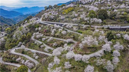
The second-class highway Project from Linxia to Dahejia is an important part of the 309 Provincial Highway, an important channel connecting Linxia Prefecture to Qinghai Province, and a major channel from Jishishan County to Linxia City, the capital of Linxia Prefecture, and Lanzhou City, the provincial capital. The starting point of the project is located in Jianhan Town, Linxia City, and the ending point is at K243+287.6 on the S309 line of the Qinghai Coast of the Dahejia Yellow River Bridge in Jishishan County. The total length of the route is 74.767 kilometers.

The geological conditions for the construction of Linda Road are complex, and the foundation soil along the line is generally composed of soft soil, silty clay, red clay, and medium to weak expansive soil. One side of the line relies on a mountain, which has a relatively loose texture. Due to road construction, the original vegetation has been destroyed, forming a large area of exposed slope surface. At the same time, the concentration of abandoned soil provides a large amount of easily eroded loose deposits for the development of landslides and other landslides. According to on-site observations, there are 4 locations prone to geological hazards such as landslides and talc, and there are 4 potential landslide hazards in the main road structure.
2. Monitoring Content
Monitoring Content List
| Category | Serial number | Monitoring content | Monitoring device | Monitoring purpose |
| < br />Beizang Mountain Slope (Construction Pile No. 182) | 1 | Internal displacement of soil | Wheel type fixed inclinometer | Monitor internal displacement of soil |
| 2 | Groundwater level | Pore water pressure gauge | Monitoring groundwater level | |
| 3 | Slope of retaining wall | Box type fixed inclinometer | Monitoring the deformation of retaining walls||
| 4 | Soil pressure gauge | Monitoring the stress situation of retaining walls | ||
| 5 | Rainfall | Rain gauge | Monitoring rainfall situation | |
| Zhaizigou slope (construction pile number 203+400) | 1 | Slope surface displacement | GNSS | Monitor the displacement of the slope surface |
| Xiaohongping 1 # Slope (construction pile number 218+300) | 1 | Slope surface displacement | GNSS | Monitor the displacement of the slope surface |
| < br />Xiaohongping 2 # Slope (Construction Pile No. 227) | 1 | Internal displacement of soil | Wheel type fixed inclinometer | Monitor internal displacement of soil |
| 2 | Groundwater level | Pore water pressure gauge | Monitoring groundwater level | |
| 3 | Slope of retaining wall | Box type fixed inclinometer | Monitoring the deformation of retaining walls||
| 4 | Retaining wall pressure | Soil pressure gauge | Monitoring the stress situation of retaining walls | |
| 5 | Rain gauge | Monitoring rainfall situation |
(1) Internal displacement monitoring of soil: Internal displacement monitoring can not only measure the creep inside the slope, but more importantly, it can understand the displacement of the slope, especially the sliding zone.
(2) Rainfall monitoring: Rainfall monitoring mainly considers engineering reality and has a direct relationship with water level changes and soil moisture content. When the rainfall is too high, the possibility of slope instability increases, so it is necessary to monitor the environmental rainfall.
(3) Monitoring of retaining wall inclination: By monitoring the inclination of the retaining wall, the degree of inclination of the retaining wall can be understood.
(4) Monitoring of retaining wall pressure: By monitoring the pressure of the retaining wall, the lateral pressure acting on the retaining wall can be understood. And combined with the inclination of the retaining wall, understandthe safety condition of the retaining wall.
< br />III. Monitoring Significance
(1) By monitoring relevant content and establishing a monitoring system, the operational status of the four slope structures can be monitored in real time, effectively ensuring the stability of the slopes and the safety of highway traffic.
(2) Understand the monitoring content related to four slopes, such as slope displacement, groundwater level, retaining walls, etc. When the warning value is exceeded, timely warning can be given to achieve real-time safety alarm of slope service level, and notify relevant units to take corresponding measures in a timely manner.
(3) By monitoring data, effective assessment of disasters can be conducted, providing decision-makers with relevant basis, making slope maintenance plans more reasonable, and reducing slope maintenance costs.
(4) Reasonably allocate highway maintenance and repair resources, provide scientific and technological basis for reducing slope operation and maintenance costs, and ensure that the development of slope inspection and maintenance strategies is targeted, timely, and efficient.
(5) Provide data support for scientific research. By monitoring the slope and obtaining raw data on structural strain, relevant data and analysis services are provided for scientific research.
(6) To verify the design and construction theory and methods of slopes, as well as the construction technology, in order to improve the relevant design and construction technical regulations, enhance the design level and safety reliability of slope design and reinforcement methods, and understand the governance effect, ensuring the safety of highway traffic, has important social significance, economic value, and broad application prospects.