




Ganzhou City Disaster Monitoring Project
- Construction Background:
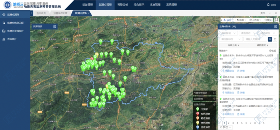
Ganzhou City is one of the most serious geological disaster prone and frequent areas of rainstorm type landslides, collapses, debris flows and other geological disasters in Jiangxi Province, with many hidden dangers, wide distribution, serious threats and other serious problems. Advanced information technology and geological disaster safety monitoring work are deeply integrated to comprehensively improve the level of disaster prevention and mitigation is imminent. According to the unified deployment of the Ministry of Natural Resources and the Provincial Department of Natural Resources, at the end of 2020, the central government issued a subsidy of 14.3 million yuan in advance for Ganzhou City in 2021, specifically for the construction of 220 universal monitoring and early warning points in 5 counties (cities) including Ruijin, Yudu, Anyuan, Xunwu, and Dingnan. The project implementation can provide real-time monitoring and early warning for 7197 people from 1218 households threatened by geological disasters, and protect threatened property worth about 170 million yuan.

Faced with the severe situation of frequent occurrence of geological disasters in Ganzhou, the Ganzhou geological disaster project team ultimately selected 220 monitoring universal warning points (mainly 198 landslide hazards and 22 collapse hazards), mainly distributed in five counties and cities of Ganzhou City, striving to deploy reasonably, install scientifically, and exert practical effects.
Project Overview:
On the basis of fully collecting, investigating, and studying the geological background and the development status of geological hazards in Ganzhou City, freesun Technology, combined with the severity of geological hazard prevention and control tasks in various districts and counties, deployed and installed 1114 equipment in a centralized manner, and finally completed the construction of 220 monitoring and early warning points in the city, achieving dynamic monitoring and real-time release of warning information for all geological hazard points, truly playing a "leading role" in disaster prevention and reduction, and fully ensuring people's safety.
The geological hazard warning mechanism is based on a comprehensive analysis of macro indicators (group monitoring and prevention), automated monitoring (data analysis), and regional warning (geological hazard meteorological forecasting). The monitoring results of displacement deformation, displacement deformation rate, and acceleration determine the warning model, with a total of four levels of warning.

Equipment installation diagram
Data Analysis Operations:
Equipment data is integrated with government management platforms at all levels, and alarm information is uploaded in real-time and platform alarm instructions are received. Real and effective monitoring data is used to assist management units in taking timely measures and minimizing personnel and property losses.


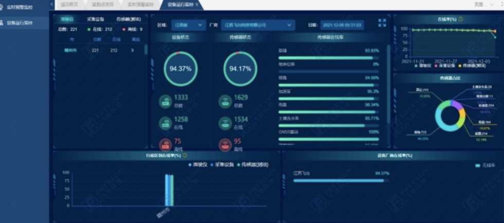
Geological Hazard Monitoring and Early Warning Management System Platform - Equipment Operation Monitoring
The professional operation and maintenance team of freesun Technology combines advantageous algorithms with big data analysis to display the status of geological hazard hidden points in Ganzhou City through periodic reports. Based on demand, they embed flexible forecast alerts for timely push, respond to emergencies in a timely manner, and analyze phased achievements, providing comprehensive perception application services. 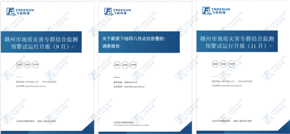
Operations Service Report
Successful Warning Case:
On May 6, 2021, a geological hazard monitoring and early warning system was installed in Liukeng Village, Huanglin Township. The monitoring and early warning system detected that the displacement began to gradually increase, and at 13:00 on May 9, there was a certain upward trend. The crack deformation rate reached 52.6mm/h in the first hour, triggering a red warning and sounding an alarm. After receiving the report, the Natural Resources Bureau of Yudu County immediately activated emergency response and provided guidance to relevant departments in Huanglin Township to organize the evacuation of threatened personnel on site for safe haven.
On May 10th, the Natural Resources Bureau of Yudu County conducted a detailed investigation and review of the site. After detailed on-site investigation, it was found that the slope of the hidden danger point had slid, forming a landslide with a front edge width of about 15 meters, an inclined length of 18 meters, an average thickness of about 2 meters, and a volume of about 540 cubic meters. Multiple tensile cracks appeared at the rear edge of the hillside, with a length ranging from 10 to 15 meters, a width of 10 to 15 centimeters, and a depth of about 0.5 meters. The landslide mass has not completely slid down, and the slope is still in an unstable state, posing a threat to the safety of residents' lives and property below the slope.
The County Natural Resources Bureau organized relevant departments and group monitoring and prevention personnel to strengthen the inspection and monitoring work of the site, and set up warning signs and lines around the landslide area. It is strictly prohibited for unrelated personnel to enter the landslide threat area. After the soil is dry and sunny, the accumulation and landslide body will be cleaned up and further engineering treatment will be carried out. Thus, a landslide that endangered the lives and property of 22 people was successfully avoided.

Rainfall and crack correlation analysis diagram
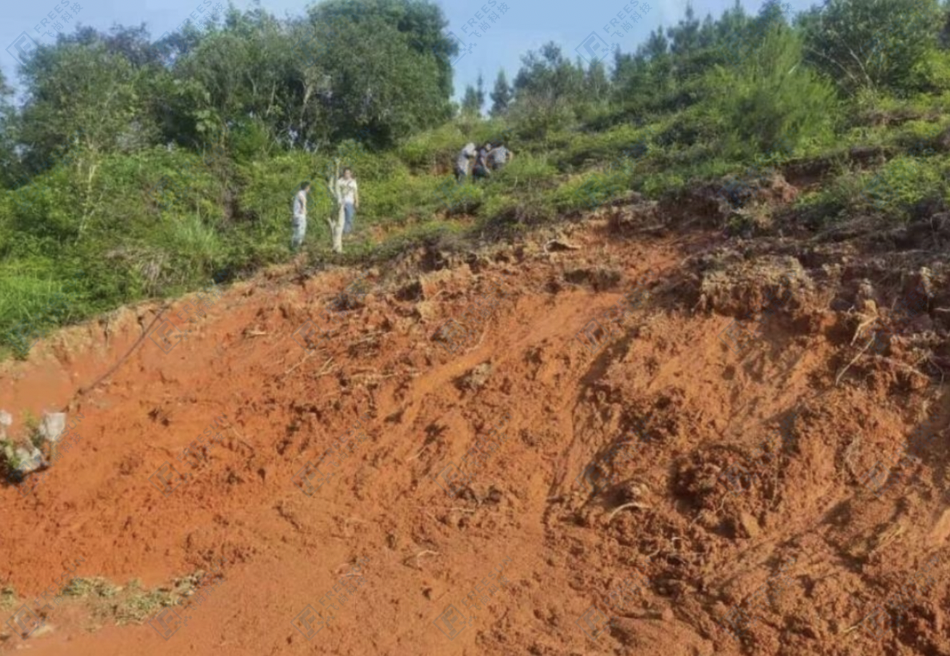

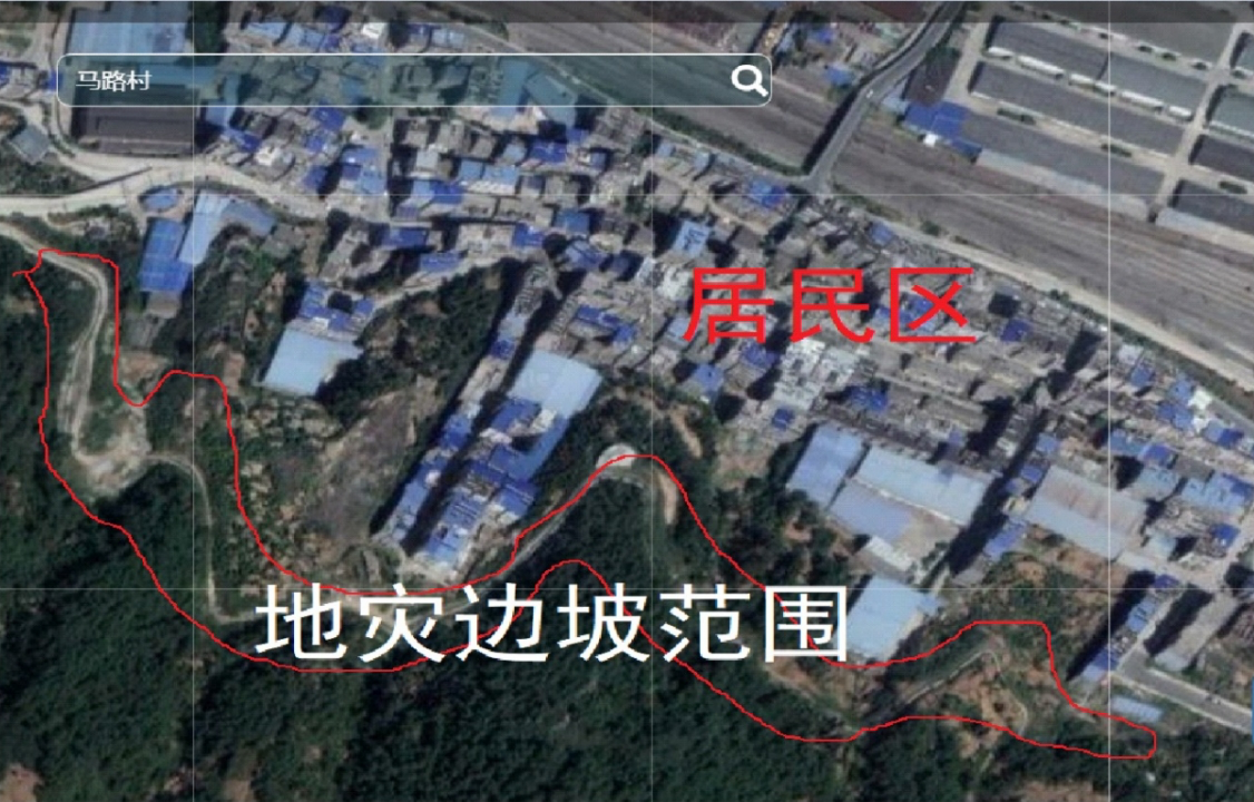
On site landslide hazard point behind the house of 5 households with 22 people in the new house under the group of Liukeng Village, Huanglin Township
Value and Benefit:
The monitoring equipment integrates multiple functions such as information collection, transmission, analysis, and early warning. When the monitoring data reaches the warning value, the system will automatically issue an alarm at the corresponding level and send it to the responsible person of the corresponding management unit for emergency treatment in the first time. It realizes 7 * 24-hour real-time monitoring, timely and accurate uploading and issuing of warning information, transparent closed-loop control of operation and warning p rocess, so that possible disaster stricken areas can take timely measures and minimize personnel and property losses.
Empowering the geological hazard monitoring and early warning information system with big data, strengthening the precise identification of geological hazard risk areas, realizing dynamic monitoring and real-time release of warning information for all geological hazard points, promoting the transformation of hazard point monitoring and early warning from traditional group measurement and prevention to "human defense+technical defense", and from passive to active disaster prevention, reduction, and avoidance, truly playing a "leading role" in disaster prevention and reduction, realizing the automation, informatization, and intelligence of geological hazard prevention and control, and making every effort to do a good job in geological hazard prevention in key areas and key periods, fully ensuring people's safety.